The real estate market in 2026 has reached a point where aerial visuals are no longer a luxury but a baseline expectation for any serious listing. According to recent industry data properties featuring high quality drone photography sell up to 70% faster than those relying solely on ground level shots. This shift is driven by …
Drone Photography Tips That Make Listings Stand Out
The real estate market in 2026 has reached a point where aerial visuals are no longer a luxury but a baseline expectation for any serious listing. According to recent industry data properties featuring high quality drone photography sell up to 70% faster than those relying solely on ground level shots. This shift is driven by a new generation of buyers who demand a “birds eye” perspective to understand the full scale of a property and its surrounding neighborhood before they ever book a physical tour.
However simply owning a drone is not enough to guarantee a sale. The difference between a generic aerial photo and a cinematic masterpiece lies in the technical execution and the ability to tell a visual story. As AI powered flight and 8K resolution become the standard for professional realtors you must master specific techniques to stay ahead of the curve. These ten drone photography tips will help you create stunning imagery that captures the imagination of buyers and closes deals faster in 2026.
1. Mastering the Orbit for a Complete Perspective
The orbit shot is often considered the “hero” shot of any real estate drone sequence. It involves flying the drone in a perfect circle around the property while keeping the house centered in the frame. In 2026 most professional drones come with automated “Point of Interest” (POI) modes that handle the complex math of the flight for you. This shot is invaluable because it shows the buyer every side of the home and the roof condition and the relationship between the house and its neighbors in one fluid motion.
- Smoothness is Key: Use your drones cinematic mode to slow down the rotation for a more professional and high end feel.
- Vary the Altitude: Perform one orbit at a low 45 degree angle to show the facade and another from a higher perspective to show the lot size.
- Why it matters: A smooth orbit provides a comprehensive 360 degree understanding of the property that ground photos simply cannot replicate.
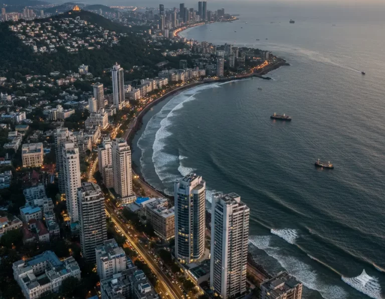
2. Highlighting Neighborhood Context and Amenities
Buyers in 2026 are not just purchasing a house; they are purchasing a lifestyle. One of the greatest advantages of drone photography is its ability to show a property in context with its surroundings. Instead of just focusing on the roofline fly the drone up to about 100 feet and tilt the camera slightly toward the horizon. This allows you to capture the nearby parks and schools and shopping centers or waterfronts that make the location desirable.
- Identify Landmarks: Position the property in the lower third of the frame while pointing the camera toward a local landmark or amenity.
- Scale and Proximity: Use a wide angle lens to show how close the home is to essential transit hubs or popular green spaces.
- Why it matters: Showing that a home is a five minute walk from a prestigious school or a beach can add significant perceived value to the listing.
3. The Low Altitude Facade Shot for Detail
A common mistake many realtors make is flying the drone too high. While high altitude shots are great for land size the most important drone photo is often taken from just 15 to 30 feet above the ground. This “elevated facade” shot provides a perspective that is slightly higher than eye level but low enough to see the architectural details of the front door and windows and porch. This height mimics the feeling of a grand entrance and makes the home look more imposing and prestigious.
- Find the Sweet Spot: Stay low enough to keep the front door as the focal point while still capturing the slope of the roof.
- Avoid Distortion: Ensure your gimbal is level to prevent the building from looking like it is leaning backward or forward.
- Why it matters: This angle offers a “stately” view of the home that ground level cameras cannot achieve without using expensive tilt shift lenses.
4. Leveraging Golden Hour and Twilight Lighting
Lighting is the single most important factor in real estate photography and drone sensors are particularly sensitive to it. In 2026 “Twilight Drone Photography” has become a massive trend for luxury listings. By flying during the 20 minutes after sunset you can capture the warm glow of the interior lights against a deep blue or purple sky. If you are shooting during the day aim for the “Golden Hour” which is the first hour of sunlight or the last hour before sunset.
- Use ND Filters: If you must shoot in the bright midday sun use Neutral Density filters to prevent your images from looking “washed out” or overexposed.
- Balance the Glow: Ensure all interior and exterior house lights are turned on before the drone takes off for a “glowing” effect.
- Why it matters: High quality lighting creates an emotional connection and makes a property look more inviting and expensive to potential buyers.
5. Immersive FPV Interior to Exterior Transitions
First Person View (FPV) drones have revolutionized real estate tours in 2026. These small and agile drones can fly through a front door and move through the living room and then fly out of a back window to reveal the garden. This single and continuous shot provides an immersive experience that makes the viewer feel like they are actually walking through the home. It is particularly effective for high end luxury estates with open floor plans and beautiful outdoor living spaces.
- Safety First: Use a drone with “Prop Guards” and obstacle avoidance sensors to prevent damage to the interior of the home.
- Slow and Steady: The goal is a smooth and cinematic flow rather than a fast and “racing” style video.
- Why it matters: FPV tours are highly shareable on social media and provide a modern “wow” factor that sets your listing apart from generic slideshows.
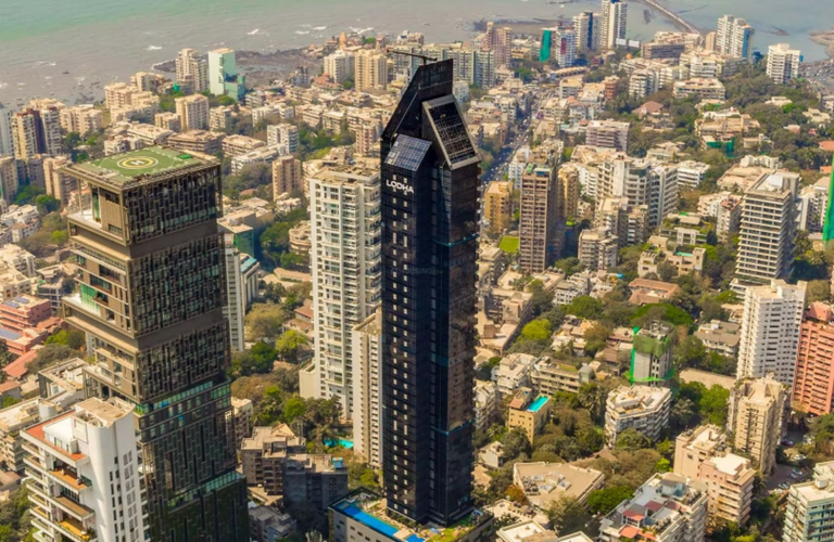
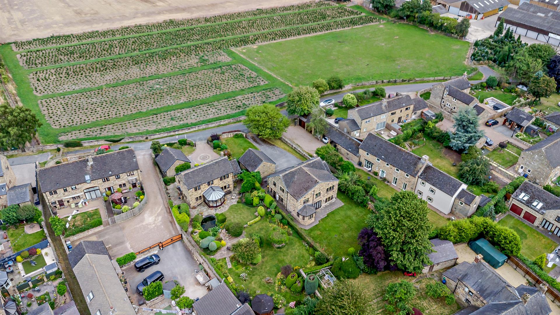
6. Highlighting Property Boundaries with Top Down Shots
For properties with large lots or unique shapes a “Bird’s Eye” or top down shot is essential. Fly the drone directly over the center of the property and point the gimbal 90 degrees straight down. This perspective is essentially a live action site map. In 2026 agents are increasingly using post production tools to overlay a colored line on these shots to clearly define the property boundaries and lot lines for the buyer.
- Clear the Yard: Before taking this shot ensure that cars and trash cans and gardening tools are moved out of sight.
- Center the Structure: Keep the main house in the center of the frame to provide a sense of scale for the surrounding land.
- Why it matters: This shot helps buyers visualize the actual size of the yard and the proximity of the neighbors and the potential for future expansions.
7. Using Automated Flight Paths for Consistency
One of the biggest challenges in drone videography is keeping the motion perfectly smooth. In 2026 most professional real estate drones feature “Waypoint” missions. You can fly the drone to specific points in space and save those coordinates. The drone will then fly that exact path automatically with a perfectly smooth camera pan. This allows you to capture the same shot multiple times at different times of day—such as once at noon and once at sunset—for a dramatic time lapse effect.
- Plan Your Path: Spend 10 minutes flying the property manually to find the best angles before saving your waypoints.
- Check for Obstacles: Ensure your automated path is well clear of trees and power lines and neighboring chimneys.
- Why it matters: Automation removes human error and ensures that your final video looks like it was filmed by a professional Hollywood crew.
8. The Dramatic Reveal Shot
The “Reveal” is a classic cinematic technique that builds anticipation. To execute this with a drone start with the camera focused on a foreground object—like a large tree or a brick wall—and then slowly fly upward or to the side to reveal the property behind it. This technique is incredibly effective for homes with long driveways or those tucked away behind lush landscaping. It creates a sense of discovery and makes the property feel like a hidden gem.
- Focus on Foreground: Ensure the drone’s camera is focused on the house as it is revealed rather than the object in front.
- Slow the Movement: Sudden jerks will ruin the dramatic effect so use the drones “Tripod” or “Cine” mode.
- Why it matters: A well executed reveal shot creates a professional and high budget look that immediately elevates the quality of the listing.
9. Post Processing and AI Powered Editing
Capturing the photo is only half the battle. In 2026 AI powered editing tools can take a standard drone shot and make it look spectacular in seconds. Always shoot in RAW format to preserve the maximum amount of data in the shadows and highlights. Use software to perform “Sky Replacements” if the day was overcast or to digitally remove unsightly objects like power lines or a neighbors parked car.
- Color Grading: Apply a consistent color grade to all your drone shots so they match the look and feel of your ground level photography.
- Brighten the Shadows: Drones often struggle with high contrast scenes so use your editing software to bring out the detail in the shadowed areas of the house.
- Why it matters: Professional editing ensures that your photos look polished and high end regardless of the weather conditions on the day of the shoot.
10. Compliance and Remote ID Awareness
In 2026 drone regulations have become much stricter with the global implementation of Remote ID requirements. To keep your business running smoothly you must ensure that your drone is registered and that you are following local laws regarding flight over people and private property. In many regions such as the US and India and the UK you must have a commercial drone license to take photos for real estate. Staying compliant not only protects you legally but also builds trust with your clients.
- Check the Airspace: Use a modern flight app to check for “No Fly Zones” or temporary flight restrictions near airports before you take off.
- Respect Privacy: Avoid pointing your camera directly into the windows of neighboring homes to prevent complaints or legal issues.
- Why it matters: Being a licensed and compliant professional shows that you take your business seriously and protects you from massive fines.
The evolution of drone technology in 2026 has made it possible for any realtor to capture world class aerial imagery with just a bit of practice. By focusing on these ten tips—from the cinematic orbit to the technical requirements of compliance—you can provide a visual experience that truly stands out in a crowded market. Drone photography is no longer about just seeing the house from above; it is about providing a strategic and emotional and comprehensive view of a future home.